GPR and EM locating were used to successfully identify a buried utility tunnel and confirm a leak location that had been preliminarily detected via thermal imaging
GPRS Assists in Locating Leaking Utility Line at Massachusetts Power Plant
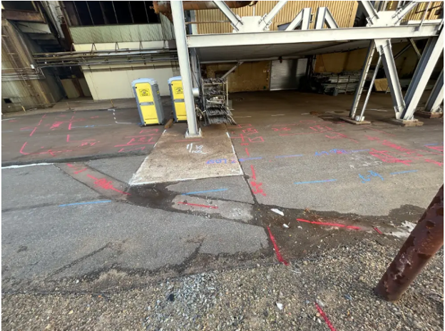
A power generation facility in Sandwich, Massachusetts identified signs of a utility line leak on its property but lacked the necessary data to determine the exact location and source of the issue.
Facility personnel initially detected thermal anomalies using an infrared camera, suggesting a potential leak. However, the affected utility line was encased within a likely concrete or asbestos-lined pipe, buried alongside other unidentified utilities at a depth of two to three feet. Compounding the complexity, two steel support pillars had been constructed over the utility corridor at some point in the past four decades.
Traditional excavation methods, such as utility potholing, were considered but posed significant risks due to the unknown utility composition and potential hazards associated with fuel and electrical conduits.

GPRS Project Manager Stephen Layon located a leaking utility line encased in a 40-year-old concrete utility tunnel.
“[This utility tunnel] has liquid gas, fuel oil, cooled water, a little bit of everything,” explained GPRS Project Manager Stephen Layon. “They have a suspected leak because they took a thermal gun and saw the radiant heat coming out of the tunnel, and they also wanted to know, when they’re digging down, if there are any utilities popping out of this tunnel because they’ve used it to kind of hitchhike through the site without having to dig a really huge trench.”
To accurately locate the leaking utility and mitigate unnecessary excavation, Layon employed ground penetrating radar (GPR) and an electromagnetic (EM) locator.
Advanced Utility Locating Technologies
GPR technology emits radio signals into the subsurface, detecting interactions with buried objects such as utility lines, conduits, and structural elements. The resulting data is visualized as hyperbolic reflections, with variations in size and shape indicating differences in material composition. GPRS Project Managers are extensively trained to interpret these signals, providing precise utility locations and depth estimates.
EM locators, on the other hand, detect electromagnetic emissions from metallic pipes and cables. These signals may originate from active electrical currents, passive signals from communications infrastructure, or applied current from an EM transmitter.
By integrating both technologies, Layon successfully identified the buried utility tunnel and confirmed the leak location that had been preliminarily detected via thermal imaging.
“I located the tunnel, located the utilities around it,” Layon stated. “Fortunately, the data was great. I could see down six-to-seven feet. I did see something that looked like a void… the data quality decreased from six-to-seven feet down to about one-to-two feet [in] the same area where the thermal camera indicated there was a leak…”
Reducing Excavation Risk and Enhancing Facility Management
Although utility potholing remains a viable method for confirming utility locations, it is costly, time-intensive, and inherently risky—particularly when dealing with high-voltage electrical lines or pressurized gas infrastructure. The data provided by GPRS eliminated the need for extensive exploratory excavation, ensuring that only a single targeted dig was required to access and repair the leak.
Beyond leak detection, Layon extended the scope of his work by mapping the expansion joints along the buried pipeline, further supporting the facility’s ongoing operations and maintenance efforts.
All findings were not only marked on-site but also digitally recorded in SiteMap® (patent pending), GPRS’ proprietary project and facility management platform. With 24/7 secure access to this data, facility managers now have comprehensive records for future maintenance planning and emergency response.
Whether identifying utilities for urgent repairs or conducting pre-construction subsurface assessments, GPRS Intelligently Visualizes The Built World® to improve safety, efficiency, and project execution.
How can we assist with your facility management needs?