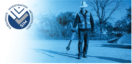
The role of subsurface utility investigations in construction, the use of GPR and EM locators, and the importance of skilled operators.
Best Practices for Subsurface Utility Investigations in Commercial Construction
Subsurface utility investigations are a critical component of commercial construction projects, ensuring that excavation, trenching, boring, and drilling activities proceed without costly delays or hazardous utility strikes. Ground penetrating radar (GPR) and electromagnetic (EM) locators are among the most effective technologies for identifying buried utilities, structural components, and other subsurface elements. However, accurate identification depends not just on the technology but on the expertise of the operator.
An inadequately trained utility locator can compromise safety and project integrity, leading to unexpected damages, project delays, and financial liabilities. To mitigate these risks, contractors should hire professional utility locators who adhere to Subsurface Investigation Methodology, a structured framework that ensures precise and reliable utility locating results.
Subsurface Investigation Methodology requires 80 hours of classroom and 320 hours of mentored field training for 101 certification.
Understanding Subsurface Investigation Methodology (SIM)
SIM is the industry-leading standardized protocol designed to enhance the accuracy and reliability of utility locating. This methodology outlines best practices for using advanced subsurface scanning technologies, emphasizing comprehensive training, technological integration, and standardized procedures.
GPRS has adopted SIM as the foundation for its Field Team and Project Managers, achieving an industry-leading 99.8% accuracy rate across hundreds of thousands of projects. By employing SIM-certified professionals, contractors can reduce the risk of utility strikes, improve project efficiency, and enhance site safety.
Key Elements of SIM for Utility Locating
SIM is built upon three essential components:
1. Experience-Based Training
One of the most critical factors influencing the accuracy of subsurface utility investigations is the expertise of the operator. SIM mandates a rigorous training process that far exceeds industry norms. While The American Society for Nondestructive Testing (ASNT) recommends a minimum of 8 hours of training and 60 hours of practical GPR application for an NDT Level I certification, SIM-certified professionals undergo significantly more extensive training:
- Pre-Classroom Field Mentoring: Before formal training begins, candidates gain hands-on experience in the field under the supervision of SIM-certified Project Managers. This mentorship introduces them to industry expectations and operational protocols.
- Classroom Training: Candidates then complete 80 hours of intensive coursework, covering:
- Standard Operating Procedures (SOPs)
- GPR and EM principles
- Pre- and post-scan site communication
- Target mark-out techniques
- Underground utility locating procedures
- Post-Classroom Mentorship: Following classroom instruction, trainees return to the field for an additional 320 hours of supervised practical training. This period ensures a deep understanding of subsurface investigation techniques before candidates are formally recognized as SIM 101 Certified Project Managers.
Even after certification, SIM requires ongoing technical education, OSHA compliance training, and quality assurance reviews to maintain expertise and ensure best practices are upheld.
2. Technological Integration
Utilizing multiple, complementary scanning technologies is essential for precise utility locating. Relying on a single method increases the risk of undetected hazards. SIM mandates the use of both GPR and EM locators, ensuring that findings from one technology are cross-verified by the other. This approach provides contractors with high-confidence data, reducing the likelihood of costly mistakes and project disruptions.
- Ground Penetrating Radar (GPR): GPR transmits electromagnetic pulses into the ground and detects variations in material properties, identifying objects such as pipes, cables, voids, and buried structures.
- Electromagnetic (EM) Locators: EM technology detects conductive materials, such as metallic utility lines, by analyzing their electromagnetic signals.
By combining these technologies, SIM-certified professionals generate a comprehensive subsurface profile that improves safety and efficiency in commercial construction projects.
3. Comprehensive Methodology
SIM’s structured approach merges advanced training with cutting-edge technology to create a standardized system for utility locating. This methodology establishes consistent best practices across all projects, ensuring accuracy, efficiency, and compliance with industry regulations.
By following SIM’s protocols, GPRS’ Project Managers achieve an industry-leading 99.8% accuracy rate, allowing general contractors to proceed with confidence, knowing that their projects are supported by the highest standards in subsurface investigation.
Industry Standards for Utility Locating: A Regulatory Gap
Despite the precision and effectiveness of SIM, the utility locating industry lacks universally recognized standards. Unlike many other sectors of commercial construction, subsurface utility investigation remains largely unregulated, allowing underqualified individuals to operate scanning equipment without formal training. This absence of oversight increases the risk of inaccurate locates, utility strikes, and project delays.
SIM is designed to address this industry gap by enforcing stringent training and operational protocols, ensuring that only highly skilled professionals conduct subsurface investigations. By advocating for SIM adherence, contractors can protect their projects from avoidable risks and improve overall construction site safety.
Delivering Utility Scan Results: SiteMap®
Once a subsurface utility scan is complete, GPRS’ SIM-certified Project Managers capture and store the data in SiteMap® (patent pending), the company’s propreitary cloud-based project and facility management platform. This system allows contractors to access scan results anytime, enhancing project planning and coordination.
- Secure Digital Storage: Scan results are securely stored, ensuring long-term accessibility and preventing data loss.
- Mobile Access: Contractors can retrieve real-time subsurface data through the SiteMap® mobile application, enabling informed decision-making on-site.
- Project Integration: SiteMap® facilitates seamless communication between project teams, reducing misinterpretation and enhancing workflow efficiency.
Subsurface utility investigations are a foundational aspect of commercial construction, directly impacting project timelines, budgets, and safety. By adopting the Subsurface Investigation Methodology (SIM), general contractors can significantly improve the accuracy of their utility locates, reducing the likelihood of costly errors and project delays.
SIM-certified professionals undergo extensive training, utilize multiple scanning technologies, and follow structured methodologies to deliver industry-leading accuracy rates. Furthermore, by leveraging advanced digital platforms like SiteMap®, contractors can maintain real-time access to utility scan data, ensuring informed decision-making throughout the construction process.
For contractors looking to minimize risk and maximize efficiency, partnering with SIM-certified utility locating professionals is a strategic investment in project success.